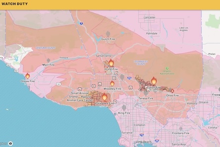
Snip: The map does not work on Google CHROME browser.
Here’s another map, which also doesn’t work on CHROME.

Breitbart: CalFire, the California Department of Forestry & Fire Prevention, has released a 3D interactive map that offers a detailed look at the multiple fires raging around Los Angeles. The map shows the perimeter of the Palisades fire and evacuation zones for multiple other fires in Los Angeles.
KTLA reports that as multiple fires rage throughout Los Angeles, the California Department of Forestry & Fire Prevention (CalFire) has released an interactive, three-dimensional map to help residents stay informed about the wildfire’s progress and affected areas. The map, accessible to the public, provides a real-time view of the Palisades fire’s perimeter and the mandatory evacuation orders and warnings in place. more

Good gawd. These people are sitting next to an unlimited amount of water, an irrational devotion to the environment, and a limited amount of common sense. Maybe they should have their windmills and solar panels dedicated to desalination plants.