Petrus sent this in saying he didn’t know if it was photoshopped or not.
It’s an accident. Looks pretty standard, no?
Look at the full picture. —>
No, it wasn’t photoshopped.
Origins: The above-displayed photographs depict a December 2006 accident in which the driver of 1991 GMC pickup slid off the road onto the right shoulder, overcorrected when he turned back to the left, and crossed over the opposite lane of the highway before crashing though a cement barrier, skirting a railing above a drainage culvert, and coming to rest facing opposite his original direction oftravel — barely missing a plunge over a 200-foot precipice by about twelve inches.
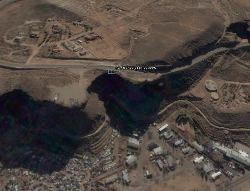
The roadway seen in these pictures is Highway 59 (i.e., State Route 59) near Hurricane City, Utah:

The Hurricane City Police department confirmed that these images “are consistent with a single vehicle traffic accident that occurred on State Route 59 in Hurricane City” on 30 December 2006, and that “Hurricane City Police and Hurricane City Fire Rescue responded to the scene.” The driver told police he was traveling at 55 mph when he left the road, but the police report of the incident notes that the truck left a 92-foot-long skid mark, suggesting a much higher speed (perhaps 75 to 80 mph).


…And the skidmark in the driver’s underwear was also at least 92 feet long.
One thing’s fer sure… you wouldn’t catch me standing on that side of the truck!
The sign says ‘soft shoulder’. That’s no shit.
I saw this many years ago. Probably when it happened in 2006?
Lucky fella.
I would’ve turned the radio dial all the way to the left to give more weight to that side of the vehicle before exiting.
That’s gotta be shopped. He cleared that ravine and landed backwards. I’m mentally calculating the speed to bust through that barricade, clear the ravine and park backwards? Gotta be Mach 5.
On a side note we deer hunt near Slab Creek Resivoir. The road in has been cut into the side of a cliff. Just wide enough to hang half a tire off the cliff edge. 3.8 miles back on the road? Meeting oncoming traffic is bitchen. You can’t see the bottom of the canyon looking over the side. I’ve been there twice. Never again.
those 2 standing between that truck and the cliff better be packing a chutes. Makes me think its shopped. No one is that crazy.
Seen this about 9 years ago.
Remind me never to drive on that road. There is a road (supposedly) on the map between Nez Perce and Kamiah, Id. that I took once as a short cut, never again, that road scared the hell out of me just because of at least 1000 ft. or better vertical drop on the passenger side going downhill towards Kamiah. And the road was barely wide enough for one vehicle. It made the road South of Lewiston, Id. towards Enterprise, Or. Rattlesnake Grade look like a piece of cake. My wife hated that road when we visited relatives down in the Wallowa valley because of it’s many sharp hairpin curves, lack of adequate guard rails and sheer drop offs towards the Grand Ronde river below. It’s beautiful but can be a very scary drive.
And that’s pronounced “Hurr-a-can” for all you non-Utahns.
there are better ones in the Smokeys nice switchbacks and such.
Damn Gov’t Motors trucks.